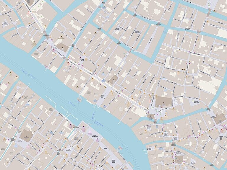
The part of the Strada Nova, which actually carries the name, passes in front of the generally overlooked Chiesa di Santa Sofia, across the Campo di Santa Sofia. The itself runs in part over the now vanished Calle di Santa Sofia.
Strada Nova
This post is part of a series on the changes made to create the Strada Nova, which connects the railroad station with the Rialto area.
Just like the nearby parishes of Santa Fosca and San Felice, the parish of Santa Sofia was a small community.
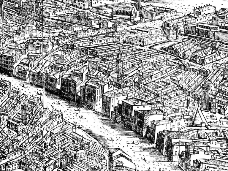
The church, the campo with a side on the Grand Canal, and a main alleyway formed the centre of the community.
The church, and probably the local community, is as ancient as everything else in Venice. Tassini refers to possible dates of foundation of the church in 866 or 1020. The church was rebuilt in the 1200s and in the 1500s, with major restorations in the 1600s.
The long side of the island on the Grand Canal boasts some significant palaces, such as the Ca’ D’Oro and the Ca’ Sagredo.
The ‘Strada Vecchia’
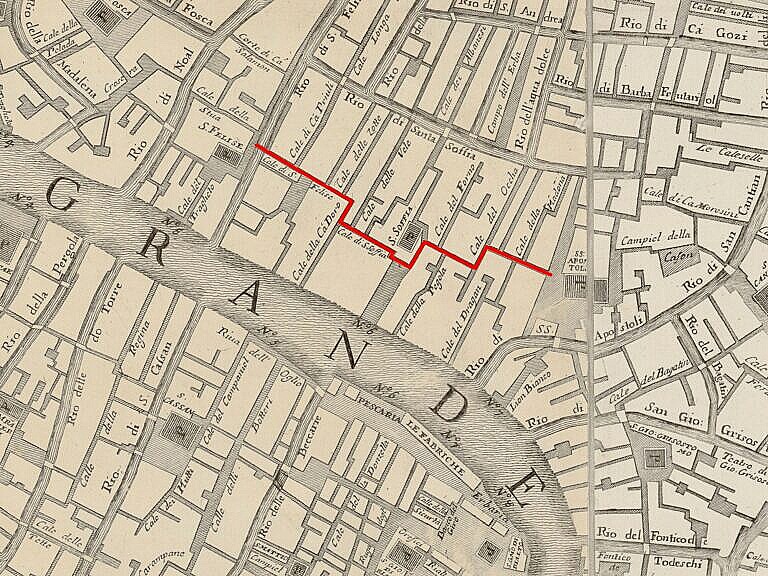
The old route from San Felice to the Santi Apostoli, before the opening of the Strada Nova, was much less direct, and much more Venetian. It was a series of narrow alleyways, occasionally opening up at a corte or a campo.
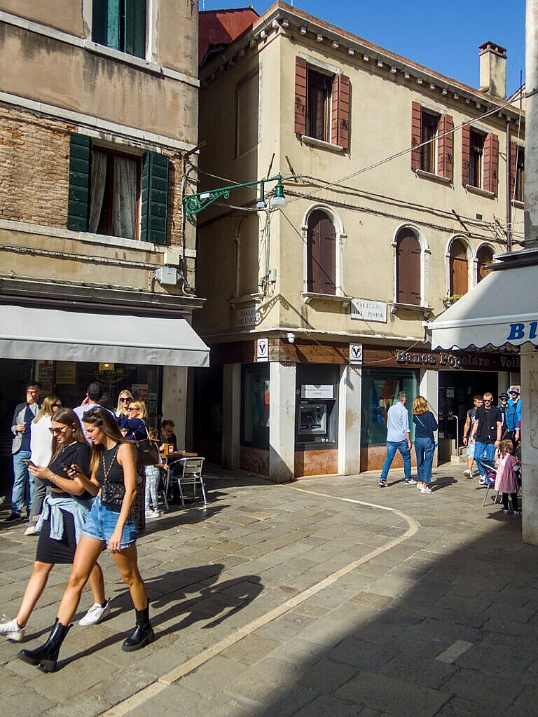
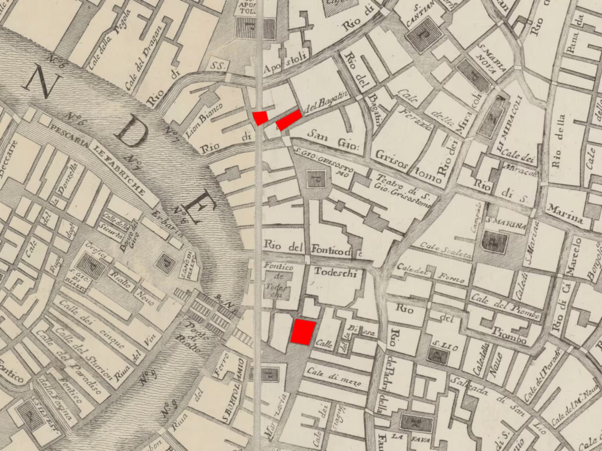
The passage from San Felice wasn’t exactly in front of the church, but a bit down the canal. The first alleyway is the Calle di San Felice. Not because it is at San Felice, it is not, but because it leads there. Halfway down, it touches the Corte dei Pali at the northern end, before continuing on the other side. This second part is now the Calle del Pistor.
A turn right at the Trattoria alla Vedova (a historic Venetian restaurant famous for their fried meatballs) into the Calle di Ca’ D’Oro. This bit is now Ramo di Ca’ D’Oro.
Then immediately left along the Calle di Santa Sofia, which ended in a corner of the Campo di Santa Sofia.
To the right of the church the winding Calle dell’Oca starts, which after several more turns, arrives in front of the church of the Santi Apostoli.
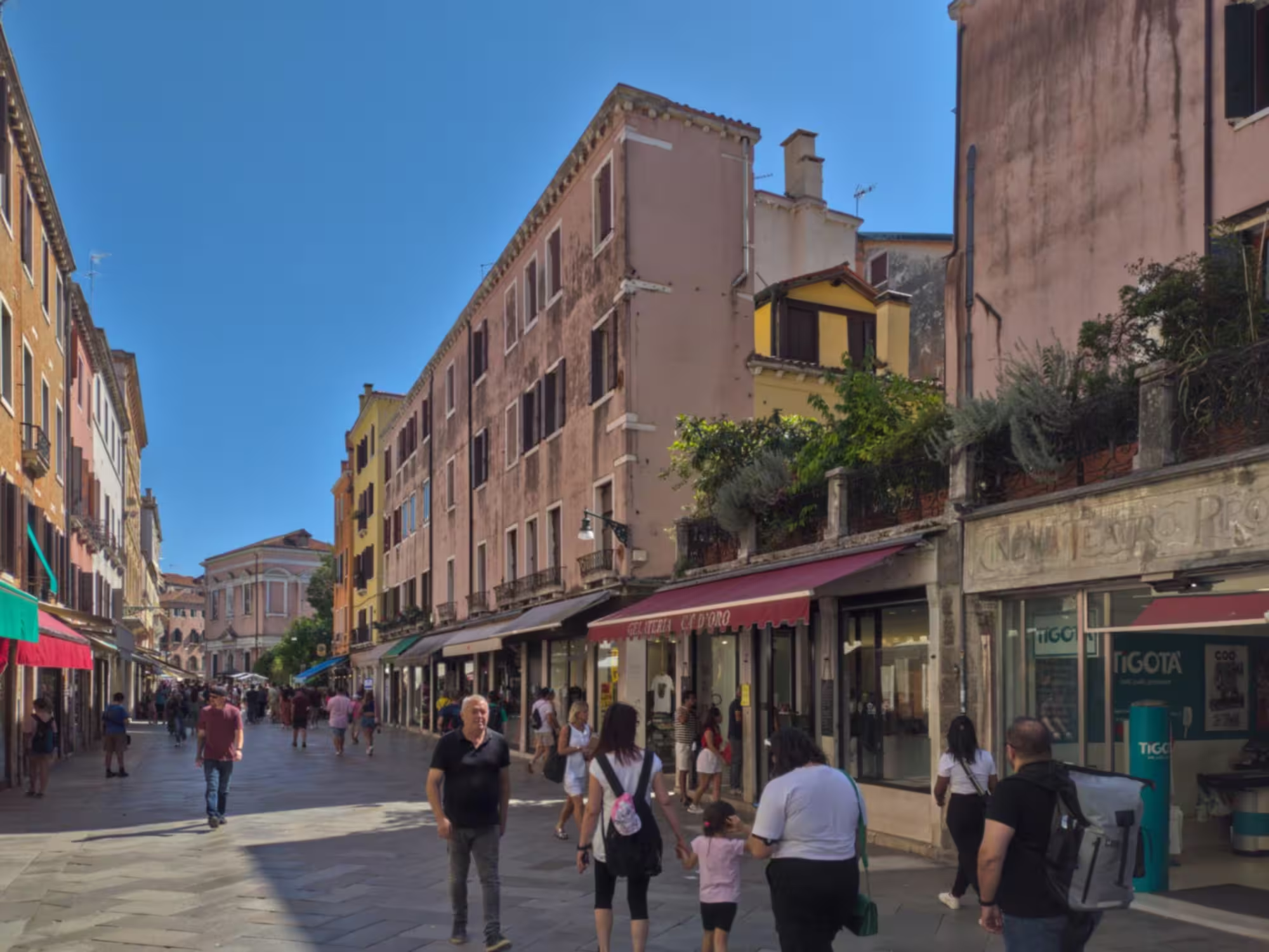
The Strada Nova
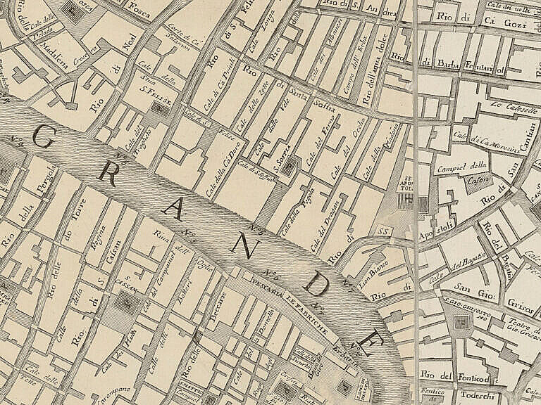
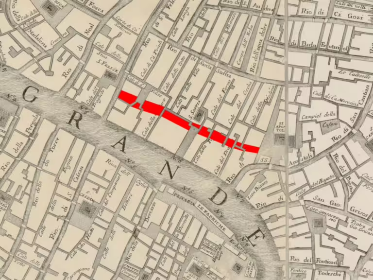
The creation of the Strada Nova meant over three hundred metres of demolitions, in almost the entire width of the road. The demolitions mostly took place in the late 1860s. The Strada Nova was formally opened in 1872.
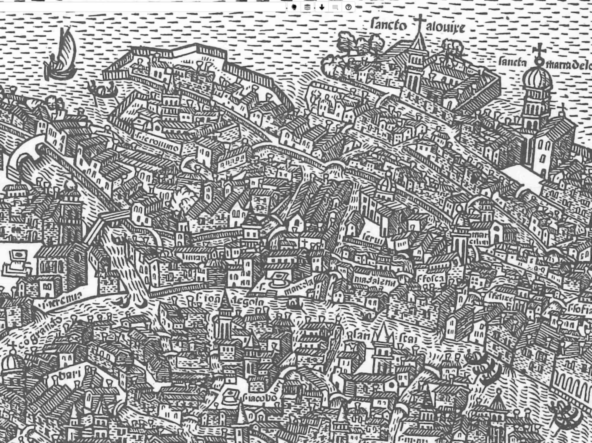
Drawn on an old map, it looks like they ran a bulldozer through the city.
There are, however, remains of the old city there, if you know how to spot them.
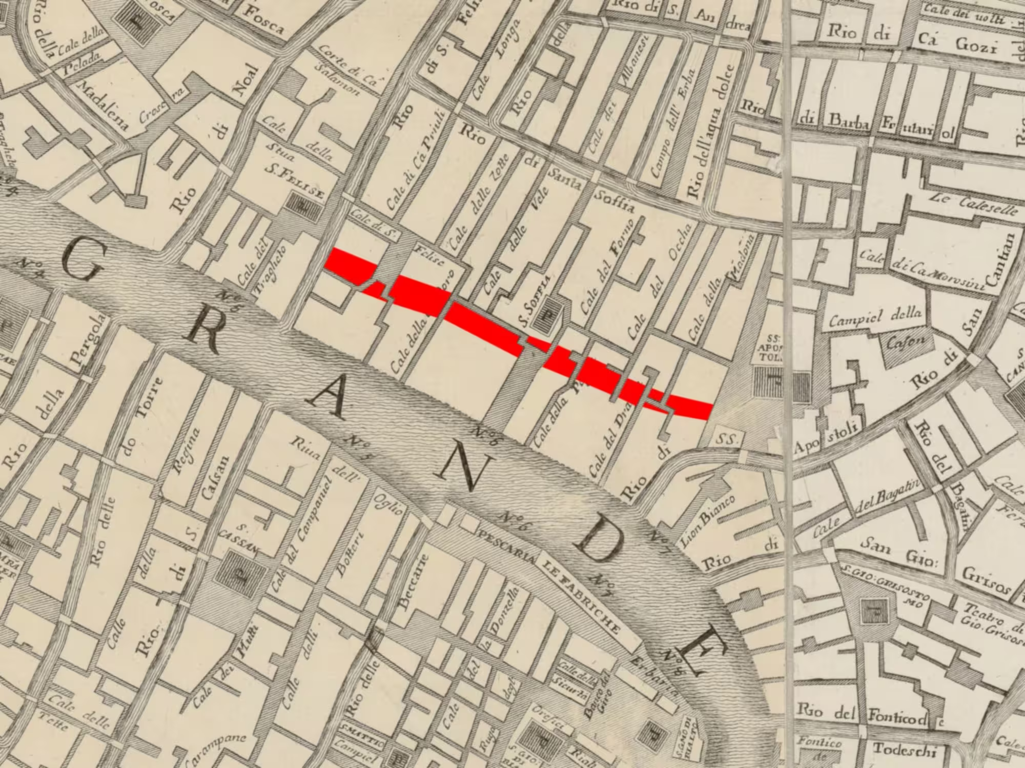
Starting from the San Felice, at the modern Ponte Pasqualigo, the Strada Nova passes through a block of houses along a minor alleyway. Half the Corte dei Pali is now part of the Strada Nova. The route then proceeds through another block of houses until the Calle di Ca’ D’Oro, which is split in two now.
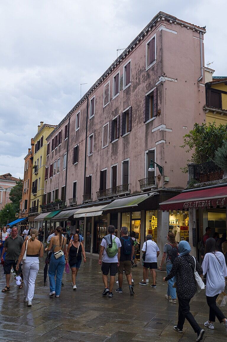
The next part of the Strada Nova has the now forgotten Calle di Santa Sofia on the right side, which is why there are palaces with Gothic and Renaissance façades here, while the opposite side of the road is completely anonymous.
Across the Campo di Santa Sofia, the Strada Nova proceeds straight a head, through another series of ancient buildings. Occasionally, it follows the path of some forgotten alleyway or crosses an old courtyard. The most tell-tale signs are the various fragments of the old road network on either side of the Strada Nova.
Now?
Nobody stops and looks at anything here because the road is basically a bypass. The very purpose of the road, as it appears today, is not to linger.
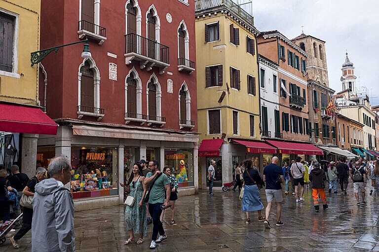
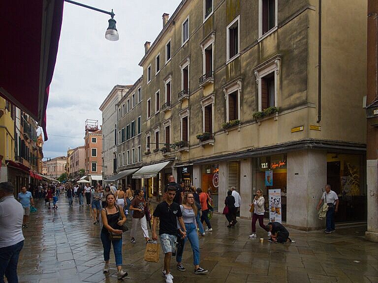
The bit of the Strada Nova which includes the lost Calle di Santa Sofia is easy to spot. There are nice Venetian houses on one side of the road, and ugly modern houses on the other side.
The two photos below are the opposite sides of the road.
Closer to the end of the Strada Nova at the SS Apostoli, there’s an odd, very long and very shallow building. The most likely explanation is that half the building was demolished, and the remaining bit given a perfunctory façade. Chel che costa de manco, as the Venetian say (“What costs the least”).
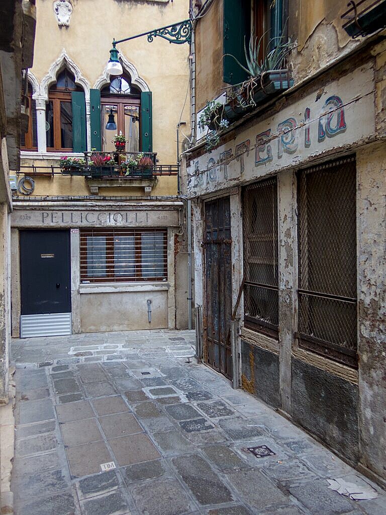
Calle dell’Oca
If one ventures into the Calle dell’Oca from the church of Santa Sofia to the Campo dei SS Apostoli, it is clear that this was once the main road in the area.
There are numerous old shop signs over the windows, some still readable, several small shrines at the intersections, and coat of arms and insignia on the houses.
These are all indications that the Calle dell’Oca was once a far busier alleyway than it is today.
In fact, where the Calle dell’Oca enters the Campo dei SS Apostoli, there’s a white line in the paving. These lines, which appears in several places in the alleyways around the Strada Nova, were route markers. The Austrians, not knowing the city quite well, marked the main routes around the city with such white lines in the paving. Here and there they have survived later road works.
Localities
This post is the sixth part of a series on the changes made to create the Strada Nova, which connects the railroad station with the Rialto area. The Strada Nova is arguably the beginning of mass tourism in Venice.
The previous post covers Santa Fosca and San Felice, and the next from SS Apostoli to Rialto.
Curiosità Veneziane by Tassini has entries on the S. Sofia, Corte di Pali, Ca’ D’oro, Calle dell’Oca, and the Strada Nuova (Via Vittorio Emmanuele).
Leave a Reply