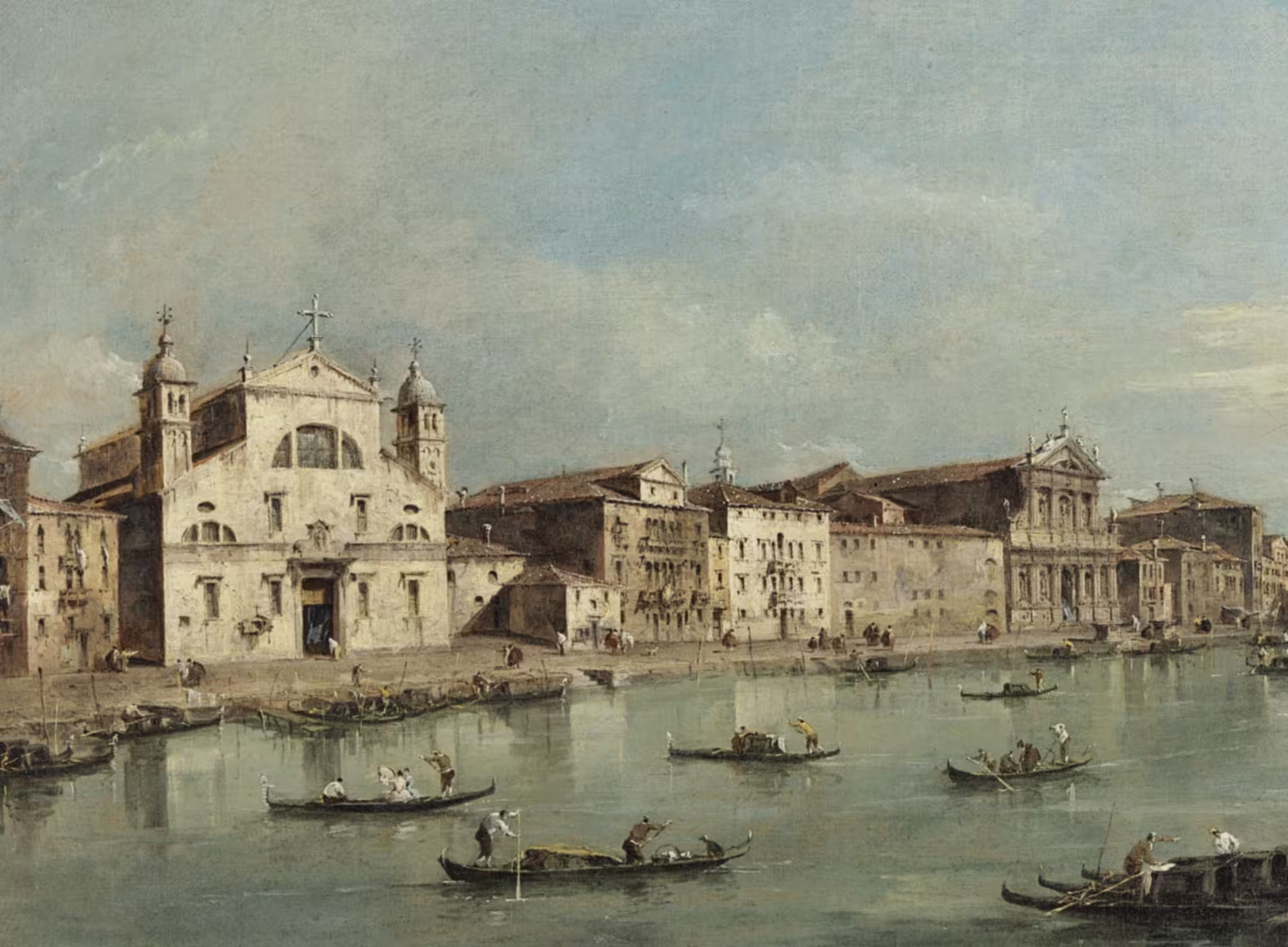
The Strada Nova passes the two ancient parishes of Santa Fosca and San Felice, each on its own island. These two island and parishes were once small communities until a series of demolitions turned them into thoroughfares for tourists.
Strada Nova
This post is part of a series on the changes made to create the Strada Nova, which connects the railroad station with the Rialto area.
A city of villages
Many of the over hundred islands that make up Venice, were small communities, more akin to villages than to parts of a big city.
The island communities often had a shared structure, which is evident from the old maps of the city.
The centre of such a community was a campo with a side on a rio, and a church. The campo was the marketplace and the social and religious centre. Often there was a main road near the campo, which could be a salizada or a fondamenta.
It is very common for the island, the church, the rio, and the campo to share the same name, usually that of the patron saint of the community.
The wealthier families had their houses facing the larger surrounding canals, or at times on the central campo. Houses, alleyways and courtyards took up the rest of the island. A few bridges connected to the neighbouring islands, but they were often on narrow alleyways and clearly not meant for intense traffic.
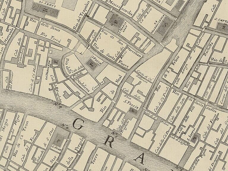
Santa Fosca
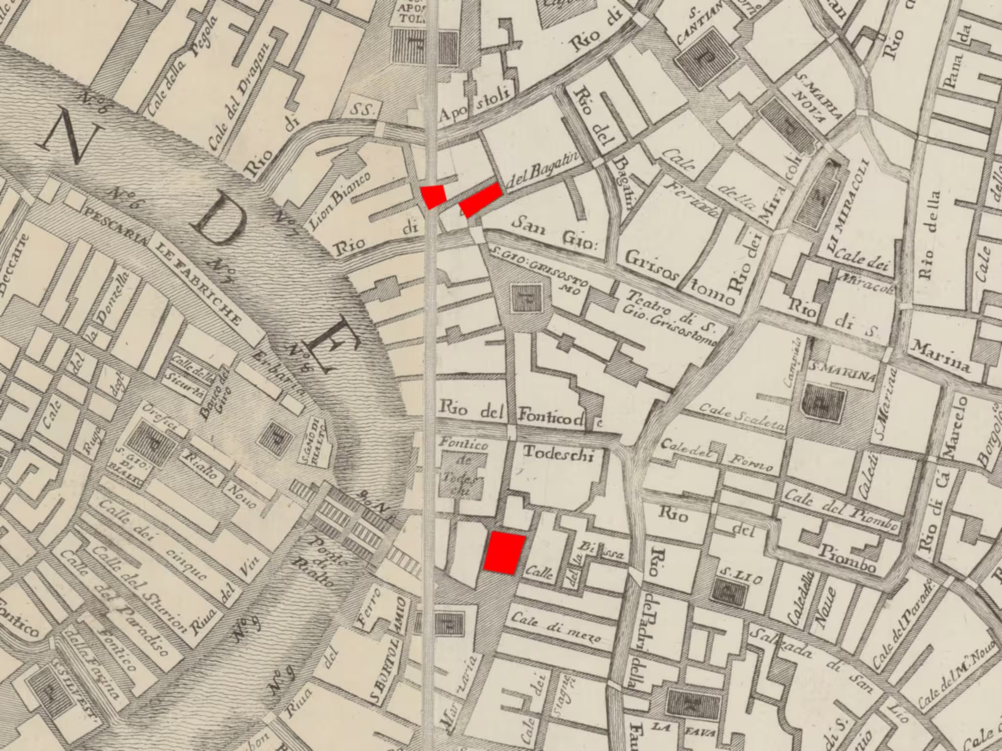
Like many similar island communities in ancient Venice, the community of Santa Fosca centred around the Campo di Santa Fosca on the adjacent Rio di Santa Fosca, in front of the church dedicated to Santa Fosca. The island also had a high street, the Salizada Santa Fosca which connected to the neighbouring island of Maddalena, and a small campiello behind the church.
Even though the south side of the island is on the Grand Canal, palaces of members of the Venetian aristocracy occupied that part of the island. The community of San Fosca was facing north, towards the Rio di Santa Fosca, or secondarily to the west, towards the Maddalena.
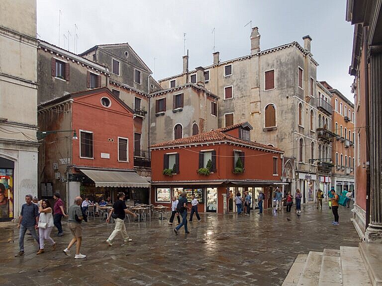
The rest of the small island was mostly narrow alleyways and buildings. The only exception was the elongated Campiello dei Fiori, with a short side on the Rio della Maddalena, which was a market for fresh flowers. The Venetians used plenty of fresh flowers, especially for weddings.
The passage to the island of San Felice was across the Campiello dei Fiori and down a narrow alleyway. The calle, the canal and the bridge all had the name Noale after an aristocratic family.
San Felice
The island of San Felice is small and elongated, wedged between two canals leading down to the Grand Canal.
Like its neighbour, San Felice has the Grand Canal on the south side. It does not, however, face that way. The orientation of San Felice was eastwards, away from Santa Fosca.
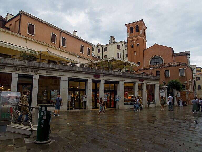
Otherwise, it was a similar small community around the Campo di San Felice, flanked by the church of San Felice. Both campo and church faced the Fondamenta di San Felice, which runs along the Rio di San Felice.
A small bridge connected San Felice to the next island with the parish of Santa Sofia, but the bridge was a bit down the fondamenta, away from the church and the campo.
Demolitions

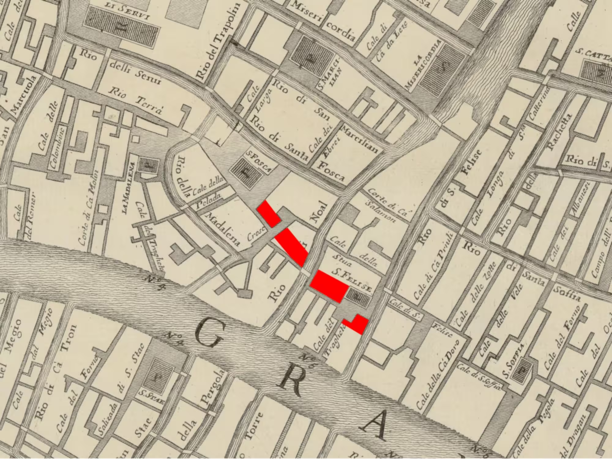
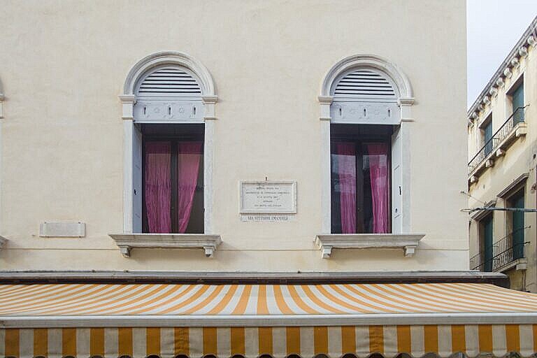
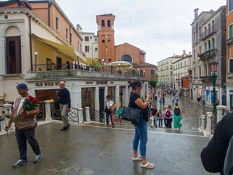
In the 1860s, the municipal administration decided to demolish four blocks of houses on the two islands with the purpose of widening the route towards the Rialto.
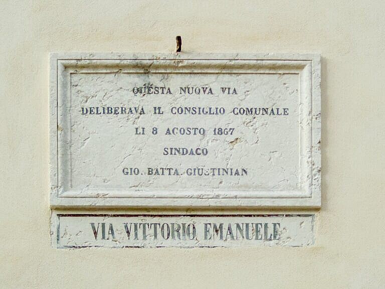
On the island of Santa Fosca the removal of two blocks brought the Salizada di Santa Fosca all the way down to the Rio di Noale, where a new wide bridge leads to San Felice.
Of the Campiello dei Fiori, which was never wider than the Salizada di Santa Fosca / Strada Nova is now, only an inconspicuous rump close to the Rio della Maddalena survives. The other side is now part of a private courtyard.
On the island of San Felice the destruction removed an entire block of houses behind the church, and some buildings on the campo. The route of the modern Strada Nova cuts across the island at an angle, compared to the ancient alleyways.
Now?
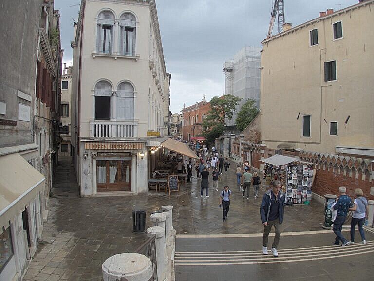
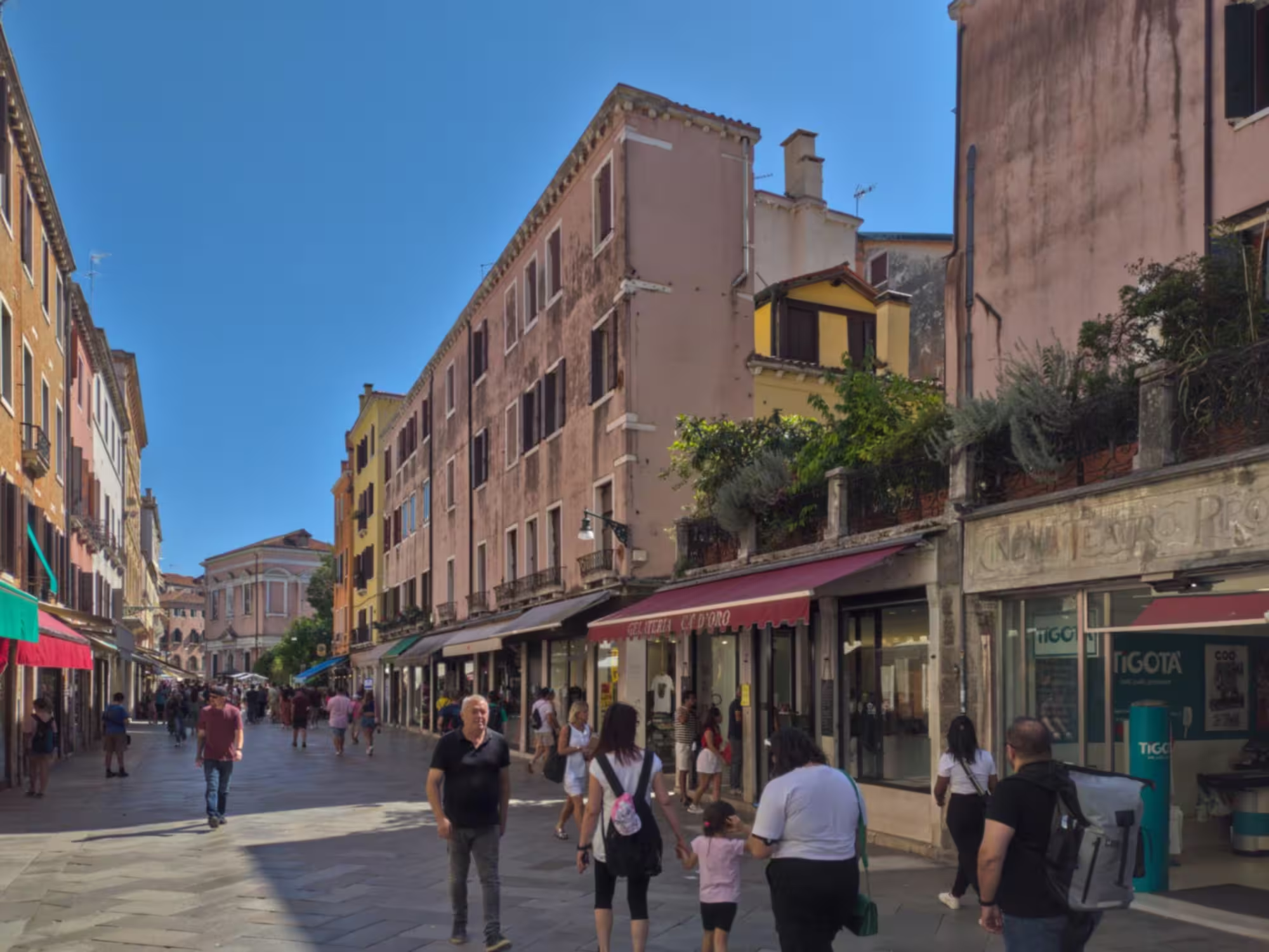
Now the Strada Nova crosses both the islands in full width with two equally wide bridges. Any sense of community has succumbed to the stream of tourists moving up and down the Strada Nova.
On the new part of the Salizada di Santa Fosca there are only shops catering to tourists, while the remaining part of the Campiello dei Fiori is practically without life. The focus of all the economic activities there are on the stream of tourists coming through.
At San Felice a low triangular modern building with a burger restaurant and a supermarket stands instead of the demolished block of houses. The Campo di San Felice is now practically invisible. It simply appears as a part of the Strada Nova.
Bibliography
- Tassini, Giuseppe. Curiosità Veneziane ovvero Origini delle denominazioni stradali di Venezia. 1863. [more] 🔗
Localities
This post is the fifth part of a series on the changes made to create the Strada Nova, which connects the railroad station with the Rialto area. The Strada Nova is arguably the beginning of mass tourism in Venice.
The previous post covers Due Ponti and L’Anconeta, and the next Santa Sofia.
The island of the Maddalena, which is located between L’Anconeta and Santa Fosca has a rio terà, which is a part of the Strana Nova route. However, that interred canal was filled in sometimes before 1398, so it is not relevant to this series of posts.do_transition_post_status_action_notify_owner
Curiosità Veneziane by Tassini has entries on Santa Fosca, Campiello dei Fiori, San Felice and the modern bridge Nicolò Pasqualigo.
Leave a Reply