
I regularly use snippets of old maps of Venice on this site.
The city of Venice, although it looks old, has undergone many changes. Alleyways, canals and buildings have disappeared, while others have appeared.
Old maps are therefore important sources to understand how the city was organised in different periods of the past. For example, I have used some of these maps extensively in the series on the Strada Nova.
Below are some of the more important maps and views of Venice, with links to hi-res or interactive versions.
La Serenissima
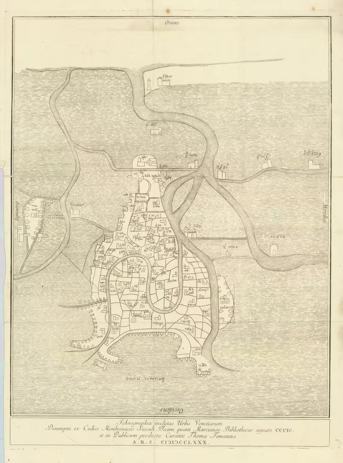
Fra Paolino – c. 1300
Ichnographia inclytae Urbis Venetiarum Desumpta ex Codice Membranaceo Saeculi Decimi quarti Marcianae Bibliothecae signato CCCIC et Publicaum producta Curante Thoma Tementia A.R.S. MDCCLXXX
This is probably the oldest existing map of Venice, from the 1200s or 1300s. The Venetian architect Tommaso Temanza found this map in the archives of the Biblioteca Marciana in the 1700s and published it later.
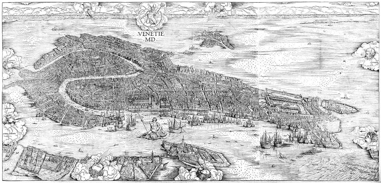
Jacopo de’ Barbari – 1500
Venetie MD
The Jacopo de’ Barbari view of Venice is justly famous. It is the earliest detailed view of Venice available, and besides being a work of art on its own, it is an incredible source to how Venice appeared half a millennium ago. The bird’s-eye view can make it hard to follow unless you already know Venice quite well. Due to the perspective, not everything is visible directly.
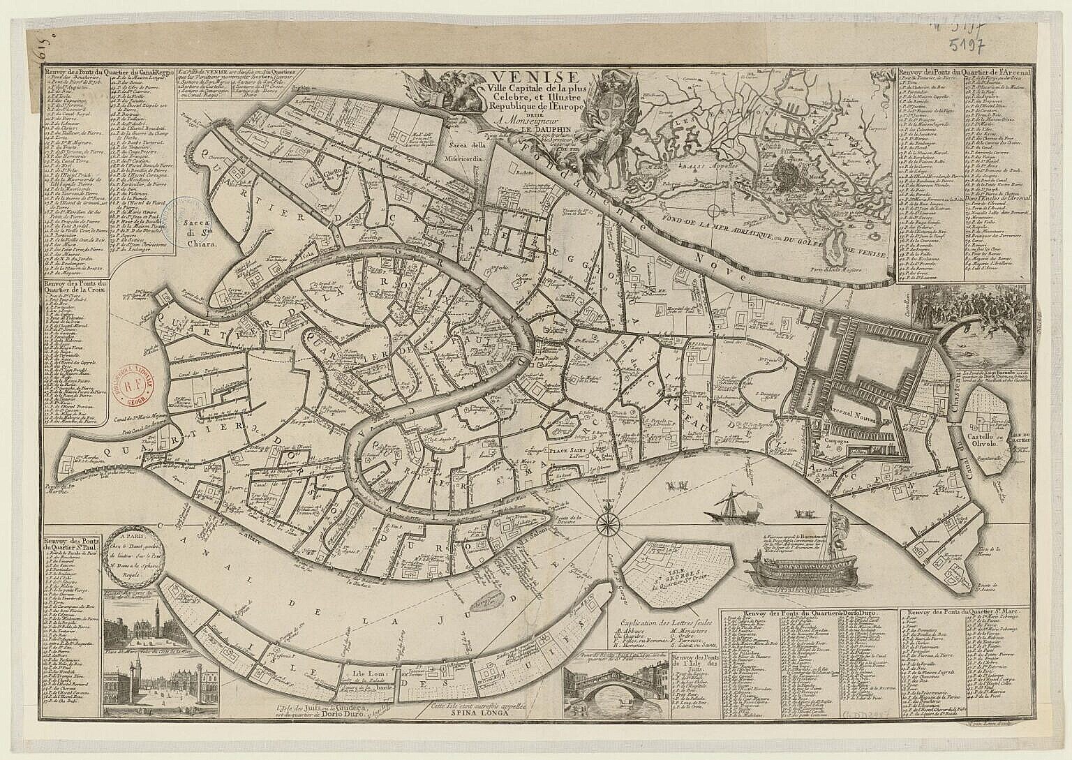
Herman Van Loon – 1725
Venise, ville capitale de la plus celebre et illustre republique de l’Europe, dédié à monseigneur le dauphin
- Bibliothèque Nationale de France via OpenMLOL (50 MPixel)
The French map by Van Loon is especially useful with regard to canals and bridges, which oddly enough is something many other maps focus less on.
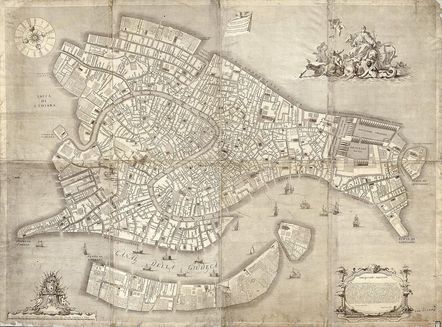
Lodovico Ughi – 1739
Iconografica rappresentatine della inclita città di Venezia consacrata al reggio serenissimo dominio veneto.
- Library of Congress via OpenMLOL (449 Mpixel)
- Bibliothèque Nationale de France via OpenMLOL (511 Mpixel)
The Ludovico Ughi map has many details, especially around the topography. Many alleyways and campi are named, even the minor ones. It definitely doesn’t detract from its usefulness that it is available online in several versions in very high resolution.
The Austrian and French periods
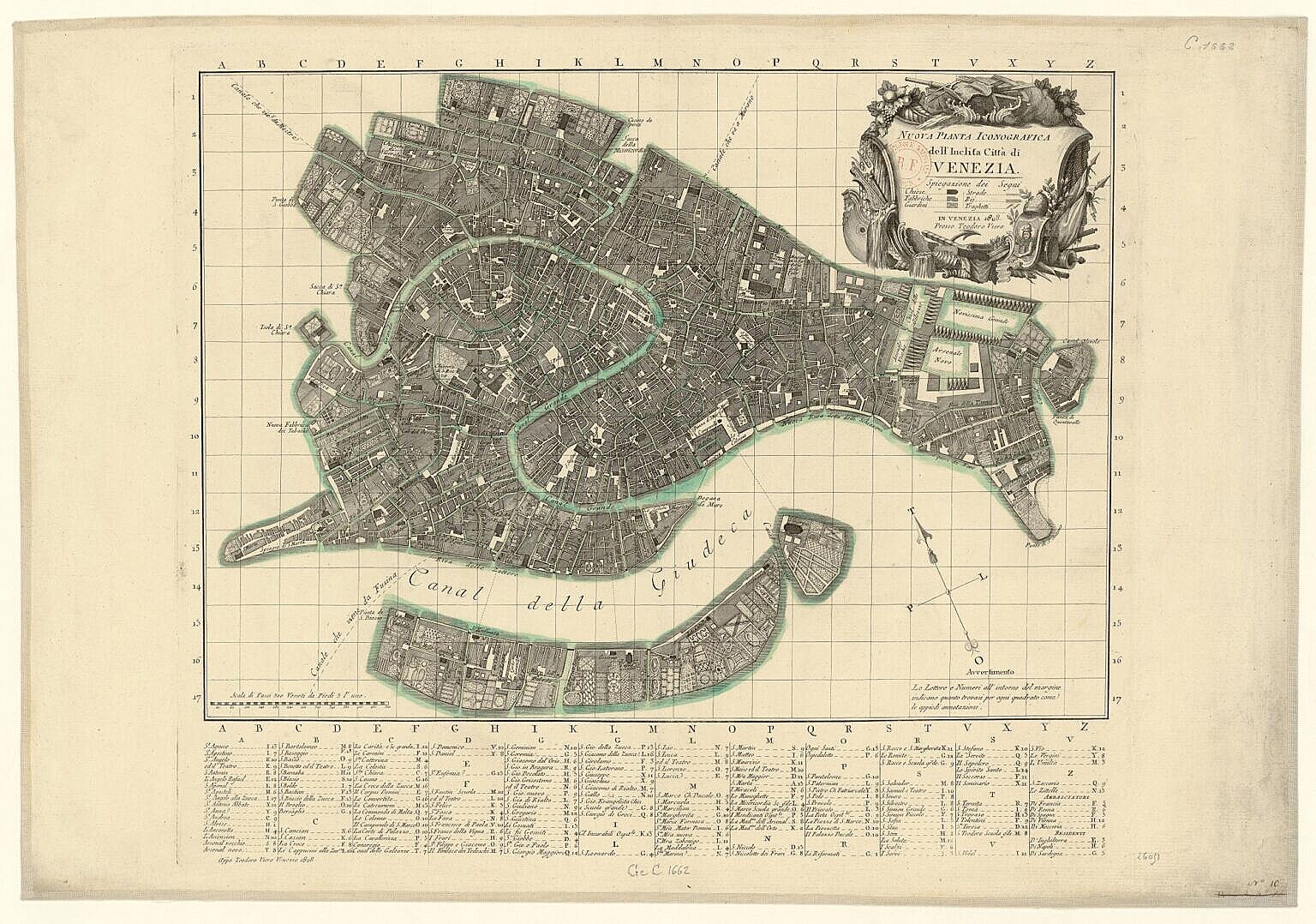
Teodoro Viero – 1808
Nuova Pianta iconografica dell’inclita citta di Venezia
- Bibliothèque Nationale de France via OpenMLOL (56 MPixel)
The Teodoro Viero map is clearly designed before the fall of the Venetian Republic in 1797. It is full of the symbols of the Serenissima and in places, like around the Rio di Castello (Via Garibaldi today), the retouching is obvious.
Leave a Reply