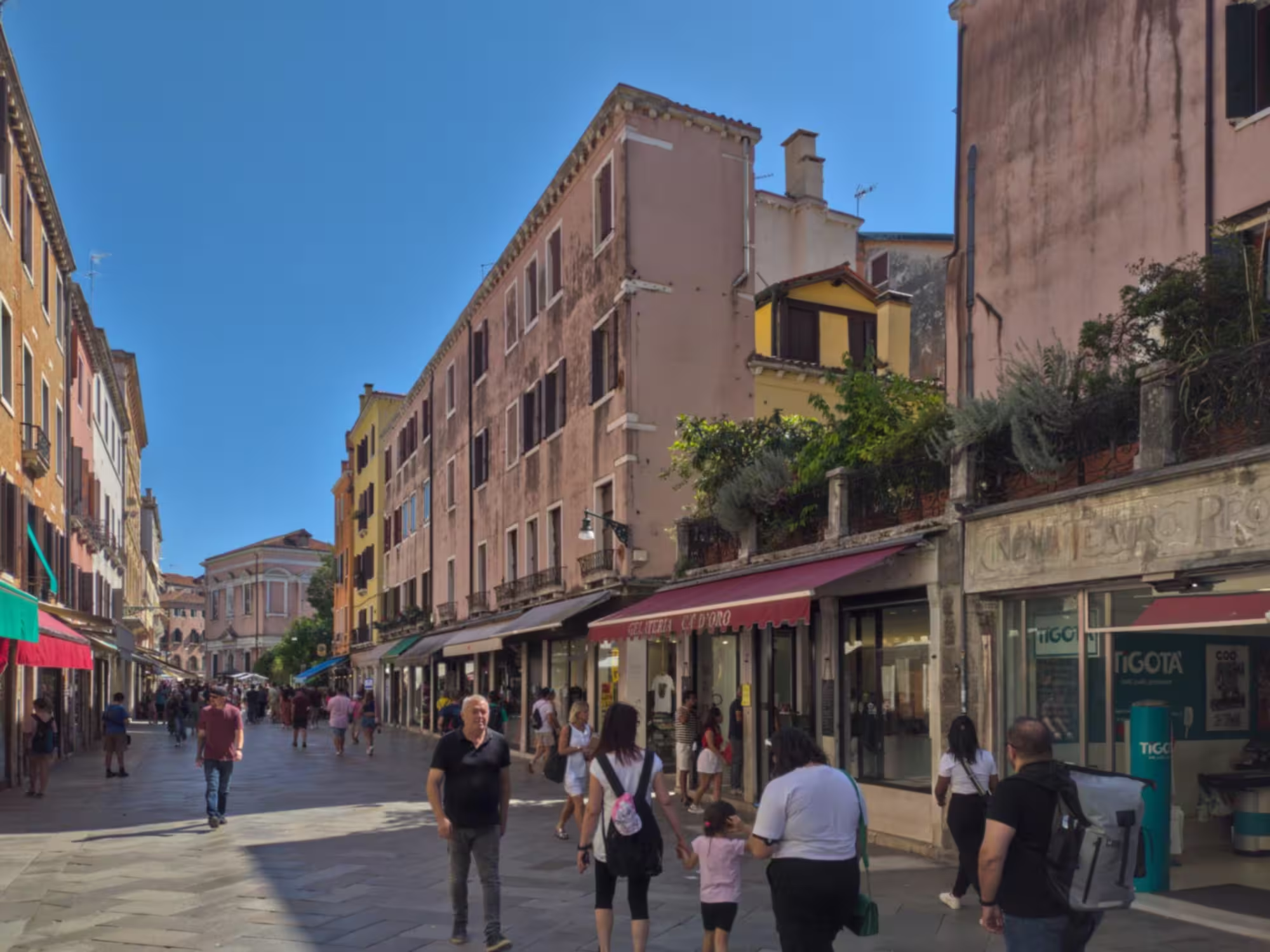
Most people arrive in Venice at Piazzale Rome or to the railroad station. From there, they walk down a series of roads towards the Rialto Bridge. These roads are collectively called Strada Nova, even though only a part of it is formally has that name.
However, the Strada Nova, the new road, prowled by tens of millions of tourists each year, didn’t always exist.
The name is already a bit of a give-away. The word strada is Italian, not Venetian, and nova (nuova in Italian) means new.
Changes to the city
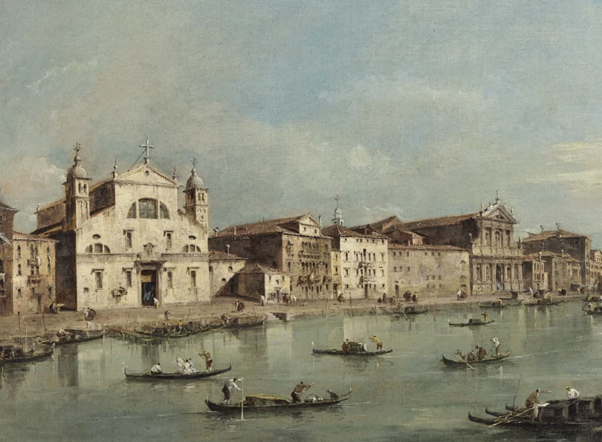
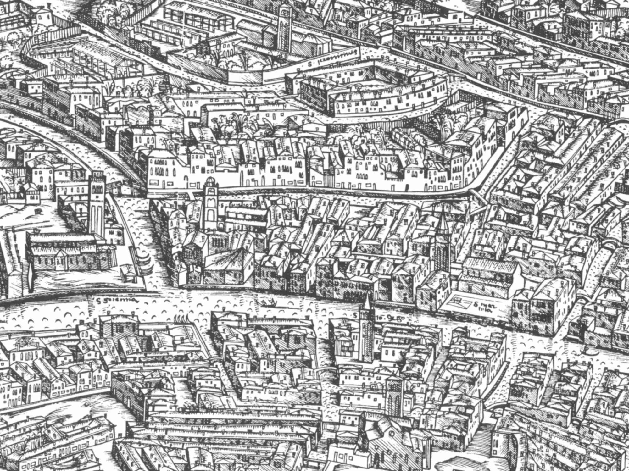
Until the mid-1800s, there was no simple way to walk from the church of Santa Lucia to the Rialto. In any case, nobody would have wanted to. Venice was a boating city, and such a trip would therefore inevitably have been in a rowed boat down the Grand Canal.
However, the Austrian rulers of Venice in the 1800s had no tradition for moving around in boats. They therefore wanted Venice to be more like Vienna, where you could walk everywhere on wide roads under the shade of trees, with cafés and shops along the way.

They also wanted Venice more integrated into the wider Kingdom of Lombardia-Venetia, which was in a personal union with the rest of the Habsburg empire. The railroad from Milan to Venice was a part of this integration.
The Strada Nova is a core element of this ‘normalisation’ and ‘integration’ of Venice, seen from an Austrian perspective.
When the Austrians brought the railroad to Venice, they built the first-ever bridge to the continent. Concurrently, then they set about making a pedestrian road from the new station to the Rialto area, the centre of the city. However, to do this they had to fill in many canals and demolish innumerable houses, which they did.
The road most tourists walk down today is very different from what Venice once was, at the time of the Serenissima, the ancient Republic of Venice.
This is the first of a series of posts exploring the changes of the urban fabric necessary to create the Strada Nova.
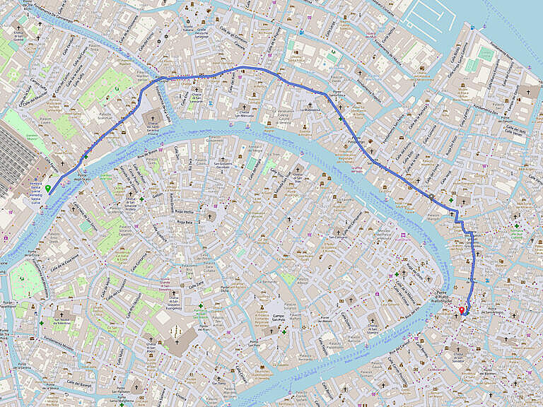
The Strada Nova route
The entire route is approximately 1.8km, so it is possible to walk it in twenty-five minutes if there aren’t too many tourists. Normally, there are, though, and it’ll take longer.
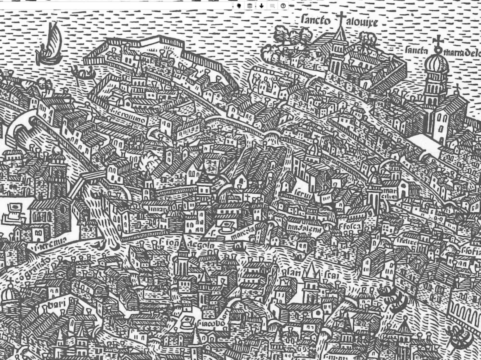
From the station to the Rialto Bridge, these are the main points of interest along the route:
- Santa Lucia and Corpus Domini
- Santa Maria di Nazareth, aka Scalzi *
- The Scalzi bridge * — see Bridges in Venice
- Rio dell’Isola
- Lista di Spagna
- San Geremia *
- Ponte delle Guglie *
- Rio di San Leonardo
- Due Ponti
- L’oratorio de l’Anconeta
- La Maddalena *
- Santa Fosca
- San Felice
- Santa Sofia
- SS Apostoli
- San Giovanni Grisostomo *
- Campo San Bartolomeo
- The Rialto Bridge *
The entries marked * have undergone no or little change in the 1800s, and are therefore not included in the discussion in this series of posts.
The rest of the series
This article is the first in a series following the route from the station all the way to the Rialto Bridge.
The focus will be on what has changed to create the Strada Nova, so what has survived the many changes is covered only cursorily, if at all.
- Santa Lucia – church, monastery and railroad station
- Rio del Isola
- Rio di San Leonardo
- Due Ponti and l’Anconeta
- Santa Fosca and San Felice
- Santa Sofia
- From SS Apostoli to Rialto
- Strada Nova – the end
Localities
More about Strada Nova
-
Santa Lucia – church, monastery and railroad station
Strada Nove #1: Where there railroad station Santa Lucia is today once stood two churches (Santa Lucia and Corpus Domini), two monasteries and much more
-
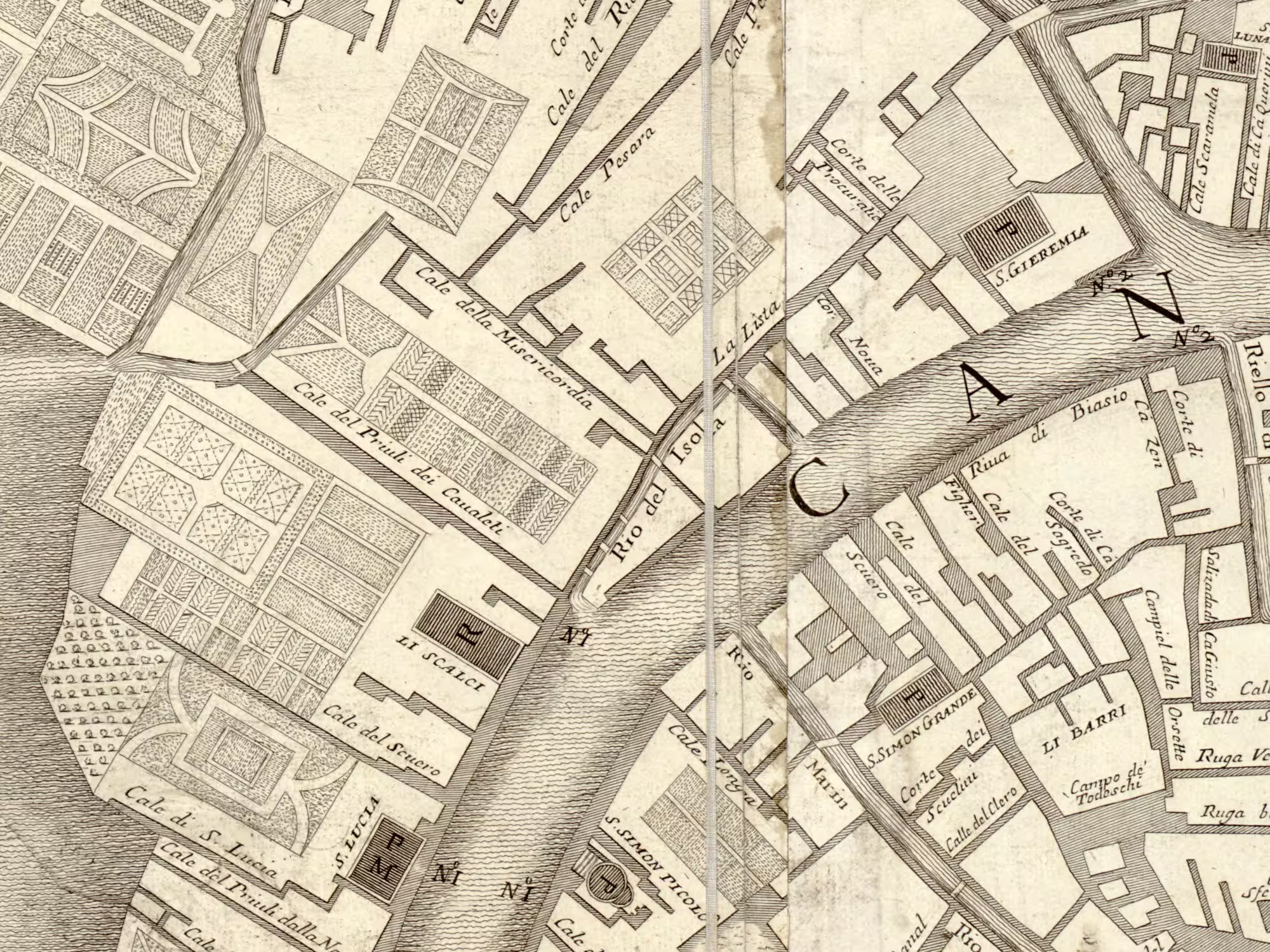
Rio del Isola
Strada Nove #2: Rio del Isola was a canal in Venice which was filled in and joined up with the Lista di Spagna to form the start of the current Strada Nova
-
Rio di San Leonardo
Strada Nove #3: The Rio di San Leonardo was interred in 1818, ostensibly for economic reasons, even though the locals complained.
-
Due Ponti and l’Anconeta
Strada Nove #4: Due Ponti and l’Anconeta were well known localities in Venice in the 1700s and earlier, but now both places are long gone.
-
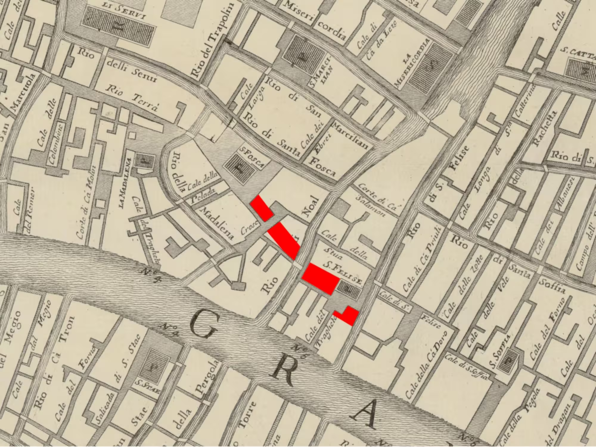
Santa Fosca and San Felice
Strada Nove #5: The parts of the Strada Nove around Santa Fosca and San Felice only exist thanks to numerous demolitions of common people’s houses
-
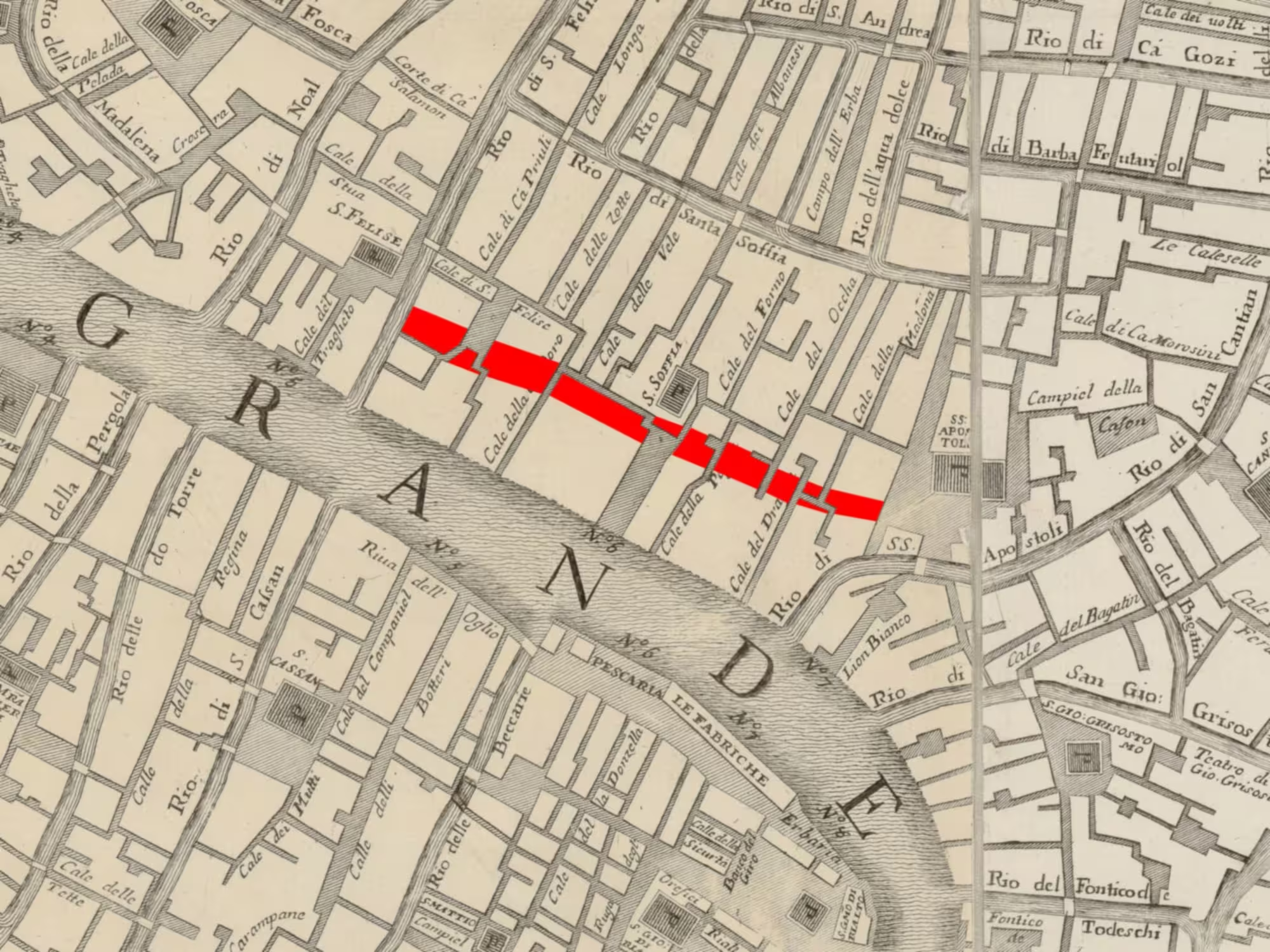
Santa Sofia
Strada Nove #6: The Strada Nova at Santa Sofia ploughs through the old city of Venice, without any regard for the city or its people.
-
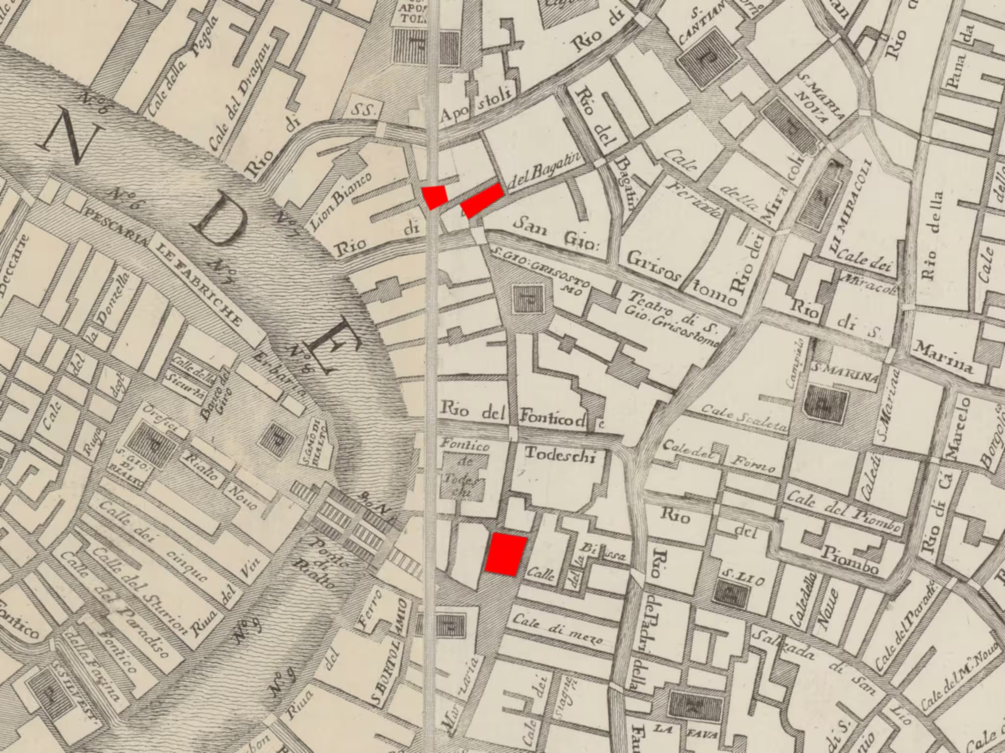
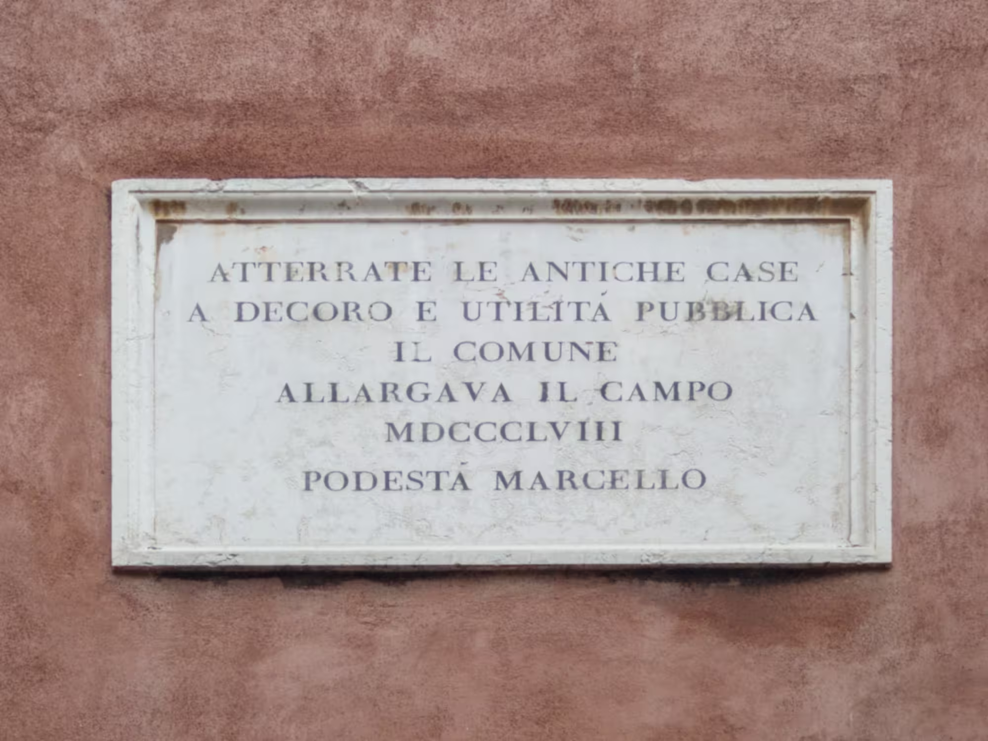
From SS Apostoli to Rialto
Strada Nove #7: The part of the Strada Nova between Campo SS Apostoli and Rialto has seen comparably fewer changes, just a bit here and there
-
Strada Nova – the end
The Strada Nova was not a single project but rather a series of incremental changes which became the start of mass tourism in Venice
Leave a Reply